
RUNWAYS 06/24 CLOSED. Runways 06/24 OPEN
Tiffenden Airfield information - Strictly PPR at all times.The airfield information below is NOT to be used for navigation purposes it is just general, non-verified information and any use of Tiffenden Airfield is at a pilots own risk. Being granted PPR allows you permission to fly in entirely at your own risk. Tiffenden Airfield is unlicensed. To request PPR, please use the Contact Form.
|

|
|
Runway Length 600metres.
Runway 25 Landing distance reduced to 400m allowing for clearance of trees. Go-arounds on 07 not advised - rising ground & trees (140ft req to clear). Radio - Tiffenden Airfield is none radio. Blind calls 'Tiffenden Traffic ' on SAFETYCOM 135.480MHz Do not expect a response.
Opening times - There are no official opening times. The airfield is operational all year depending on ground condition. Airfield Log. All pilots are requested to complete the airfield log on arrival and departure - thank you.

Tiffenden Airfield is easily located on SkyDemon.
Type in Tiffenden to locate. 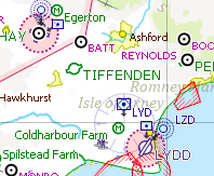
Tiffenden Airfield is easily
located on SkyDemon. Type in 'Tiffenden' to locate. Tiffenden Airfield Co-ordintes for SkyDemon N510539 E0004427 |
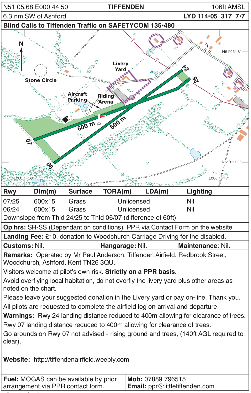
Airfield Information Plate Copyright Robert Pooley. Reproduced by the kind permission of Pooley's Flight Equipment LTD. You can visit Pooley's here.
|
|
Lat/lng in deg min sec
Latitude: 51° 5' 40.881"N Longitude: 0° 44' 29.9481"E Northing: 136395 Easting: 592074 Grid ref: TQ 92074 36395 Latitude: 51.094689 Longitude: 0.741652 Altitude: There is a 18.5 metres (60 feet) difference from one end of the strip to the other 06/07 Threshold 24m (79 feet AMSL) Strip Centre: 32m (106 feet AMSL) 24/25 Threshold 42m (139 feet AMSL) |
Tiffenden Airfield Location MApNearest Towns are Tenterden and Ashford. Nearest Licensed Airfields are Headcorn, Lydd, Rochester, Biggin Hill & Maypole.
|
Landing Fee
GO TO THE LANDING FEE PAGE.
We suggest a donation of £10 to the Woodchurch Carriage Driving for the Disabled Charity that is based at Tiffenden Airfield. Online payments make it easy. Cash donations can be left at Airfield.
GO TO THE LANDING FEE PAGE.
We suggest a donation of £10 to the Woodchurch Carriage Driving for the Disabled Charity that is based at Tiffenden Airfield. Online payments make it easy. Cash donations can be left at Airfield.
Fuel 100LL & Oil
There is no 100LL or Oil available. The nearest licensed airfield for 100LL is Headcorn. You can call air traffic at Headcorn on 01622 890226 to arrange landing and fuel.
There is no 100LL or Oil available. The nearest licensed airfield for 100LL is Headcorn. You can call air traffic at Headcorn on 01622 890226 to arrange landing and fuel.
Fuel MOGAS
MOGAS can be available by prior arrangement. Please mention MOGAS requirements in the PPR Contact form. Please note that MOGAS comes from the local garage. Use of it is at pilots own risk. We do not have a straining funnel.
MOGAS can be available by prior arrangement. Please mention MOGAS requirements in the PPR Contact form. Please note that MOGAS comes from the local garage. Use of it is at pilots own risk. We do not have a straining funnel.
Location and Information Maps
The CAA 1:500,000 map. Tiffenden Airfield marked inside yellow circle for identification. Please note that Woodchurch is no longer on the CAA maps.
To go to the Google maps click here
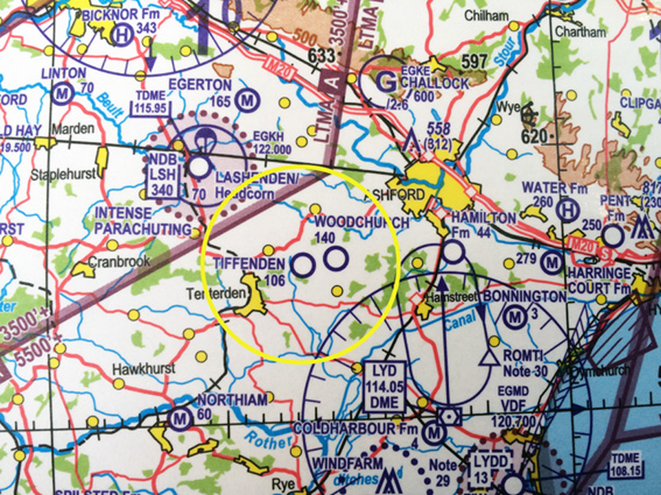
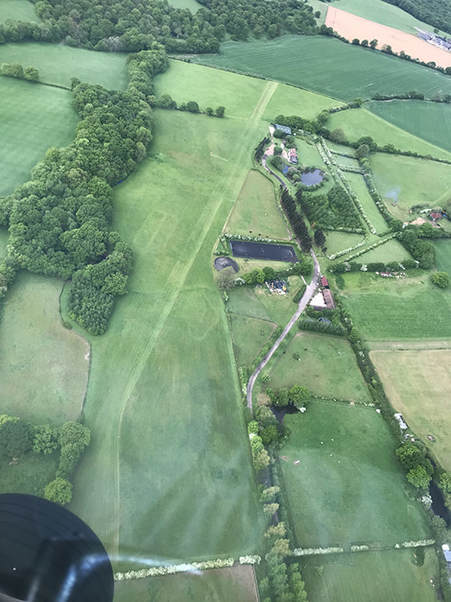
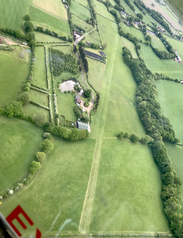
Please avoid overflying the yellow areas that designate neighbouring properties. On approach, please overfly the riding arena at 700ft to alert riders that a plane is going to land. The Stone Circle marked in red is a good landmark to identify the airstrip. Please note that there are 2 other private strips within half a mile and 2 miles. They are marked on the lower map on this page.
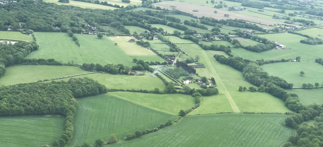
Views of Tiffenden Airfield
|
|
Other local airstrips
Other Private airstrips in the immediate area - provided to avoid any confusion in identification. More detailed photographs are below. Please note that all of these strips are private and any use requires the permission from the owners.
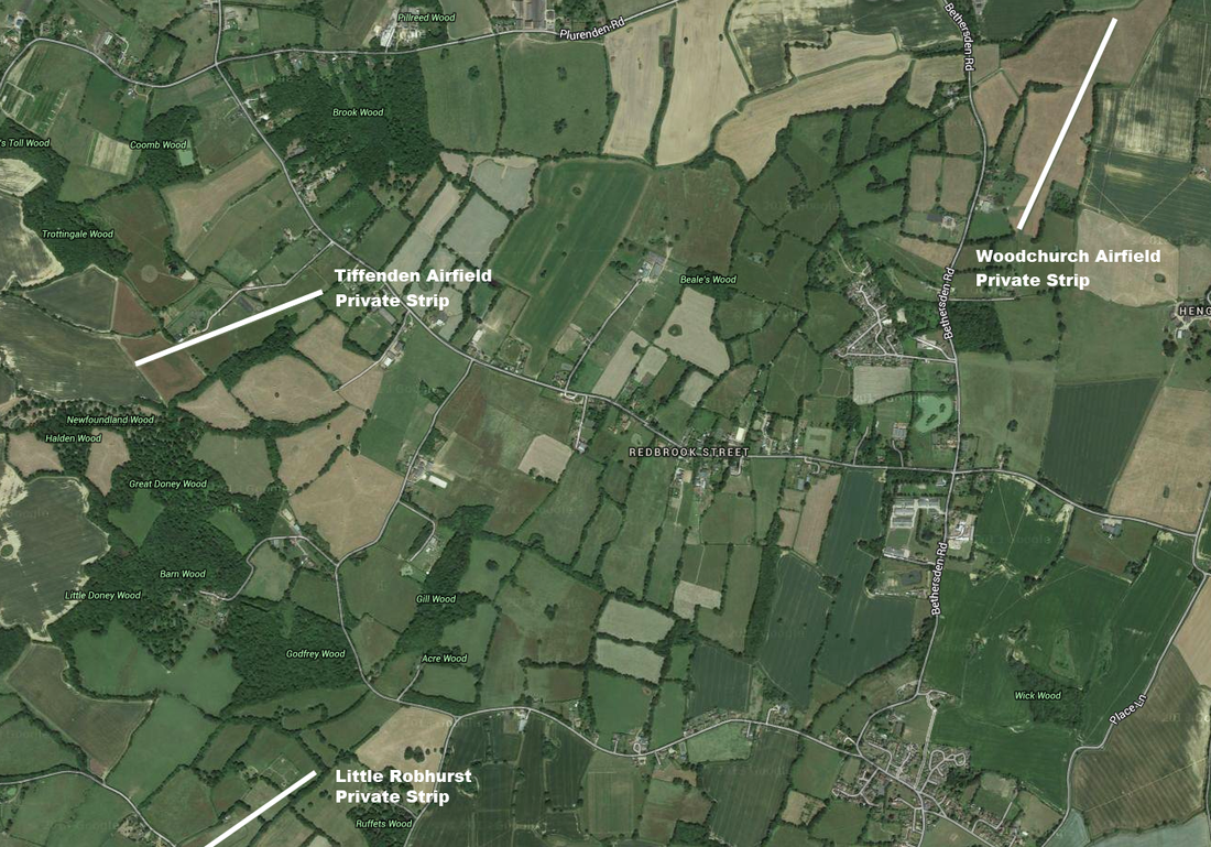
Little Robhurst Airstrip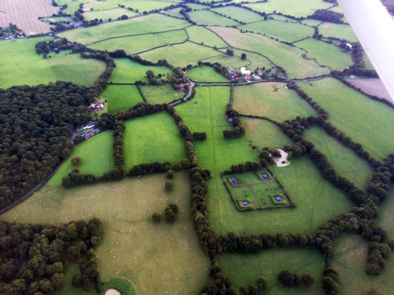
|
Woodchruch Airfield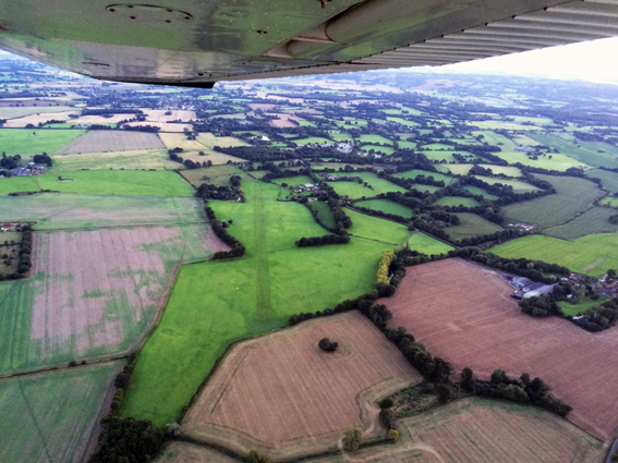
|
